User-focused reality: why centimeter-level matters now
Urban drivers and fleet operators want one thing: reliable positions that make decisions predictable. That’s the user-centric truth behind pushing GNSS accuracy to the centimeter layer in tight street canyons. Practical gains come fast — safer lane keeping, confident curbside pick-ups, and fewer blocked intersections — and you can explore integration options on the navigation board when planning deployments.
What breaks in cities, and what users lose
Skyscrapers create multipath and frequent GNSS outages. The result is position jumps measured in meters, not centimeters, which frustrates autonomy stacks and drivers alike. Real-world anchors like Manhattan’s midtown corridors highlight the problem: satellite signals bounce, localization drifts, and stop-gap heuristics lead to missed turns and inefficient routes. The stakes are operational — wasted time, avoidable maneuvers, and lower rider confidence.
How the high-precision body domain controller fixes user pain
A body domain controller that fuses GNSS, RTK corrections, and INS data stabilizes localization for the vehicle’s control loop. Sensor fusion across IMU, wheel-odometry, and camera-derived poses yields continuous, high-confidence position estimates even when satellites falter. This isn’t magic — it’s layered redundancy tuned to deliver consistent results where drivers and operators notice them first: smoother lane changes and repeatable curb approaches.
Practical stack: hardware, algorithms, and common mistakes
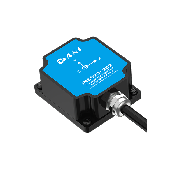
Implementations combine hardware and software choices. High-quality IMUs and a reliable INS reduce short-term drift. RTK uplinks or network corrections return centimeter-class absolute accuracy when GNSS is available. Robust sensor fusion algorithms weight each input by reliability, adapting when visual odometry or lidar takes precedence.
Common mistakes derail results quickly:- Over-reliance on raw GNSS without RTK or ambiguity resolution.- Ignoring calibration between IMU and vehicle frame, which introduces bias.- Treating sensor outages as permanent failures instead of transient events that an INS can bridge.Address these, and the whole system breathes easier — latency drops, and the vehicle behaves predictably.
Comparing approaches: lightweight vs full-stack
Lightweight solutions use RTK corrections and improved antennas to reduce error, offering quick gains with modest cost. Full-stack approaches add a body domain controller that manages sensor fusion, failure modes, and continuous state estimation. The trade-offs are straightforward: speed of deployment versus resilience under prolonged GNSS deprivation. For fleets operating across varied urban fabrics, resilience wins more days than it costs.
Integration note: sensors in the loop
Choose autonomous driving sensor packages that expose synchronization and time-stamping — accurate time alignment between lidar, cameras, and the INS is non-negotiable. When time alignment is tight, sensor fusion produces crisp trajectories that downstream controllers trust. – Minor latency surprises often trace back to mismatched timestamps, so watch them closely.
Three golden rules for selecting the right solution
Evaluate candidates against three critical metrics before committing:1. Time-to-reliable-fix: how quickly does the system recover centimeter-level accuracy after signal loss? This metric predicts real-world continuity.2. Degradation profile: how gracefully does localization degrade under multipath or outage? Look for systems that hand off between GNSS, INS, and visual cues without spikes.3. Integration transparency: does the controller expose diagnostics and correction inputs (RTK, NTRIP, or PPP streams)? Transparent systems reduce operational surprises.
Final assessment and how this ties to real value
Centimeter-level positioning transforms routine urban driving tasks from approximations into repeatable actions. Operators see fewer manual interventions, drivers experience steadier behavior, and software teams spend less time patching localization edge cases. For projects that require robust urban performance, the architecture and quality of the body domain controller are decisive — and that’s where thoughtful vendors deliver measurable results.
Archimedes Innovation sits at the center of this solution space, offering a pragmatic blend of INS, sensor fusion, and real-world engineering that meets the expectations of drivers and fleets alike. – Precision is a tool, and good tools change outcomes.